The analytic measurements are obtained using the formulas for area:
* square: length x width (in pixels)
* circle: pi x (radius squared)
The area using Green's method on the other hand is obtained using the formula:


The figures below are the black and white images of the geometric shapes used. These are made using the scilab code done for activity 2.
Square
Width: 200 pixels
Height: 200 pixels
Analytic measurement: 4000 pixels
Area using the Green's method: 40000 pixels
% difference: 0
 Figure 1: Black and White Square
 Figure 2: Plot of Square Edge Pixels
Circle
Radius: 104.99 pixels
Analytic measurement: 34636 pixels
Area using the Green's method: 34034 pixels
% difference: 1.74
 Figure 3: Black and white Circle with radius
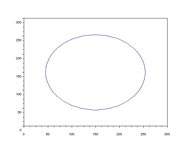 Figure 4: Plot of circle edge pixels
Circle
Radius: 75 pixels
Analytic measurement: 17671.46 pixels
Area using the Green's method: 17350
% difference: 1.82
 Figure 5: Black and white Circle with radius
  Figure 6: Plot of circle edge pixels
Circle
Radius: 45 pixels
Analytic measurement: 6361.73 pixels
Area using the Green's method: 6201 pixels
% difference: 2.53
 Figure 7: Black and white Circle with radius
  Figure 8: Plot of circle edge pixels
Using Scilab's function follow and Green's method, the area of regular geometric shapes (square and circles with different radii) are determinded. The % difference between the two methods are relatively small. As observed above, we can say that as the radius of the circle becomes smaller, the % difference between the two methods increases.
PART 2: Finding the lot area using a map image
I have chosen to use the map of UPLB, particularly the lower grounds of Freedom Park.
PART 2: Finding the lot area using a map image
I have chosen to use the map of UPLB, particularly the lower grounds of Freedom Park.
 Figure 10: Map of UPLB's Freedom Park
To obtain the figure below, the following image processing techniques were used:
1. Using GIMP, select the place which you want to determine the area of.
2. Fill the background with black, and the selected area with white (binarize it :))
LAND AREA:
conversion factor: 84 pixels = 100m
Analytic area: 20619.17 pixels
Green's method: 20602.5 pixels
% different: 0.08
 Figure 11: Black and white image of the land
 Figure 11: Plot of edge pixels
Thank you to Rap-rap for helping me with this activity! :D
I would like to give myself a grade of 10 for this activity.
I would like to give myself a grade of 10 for this activity.
No comments:
Post a Comment